Overview
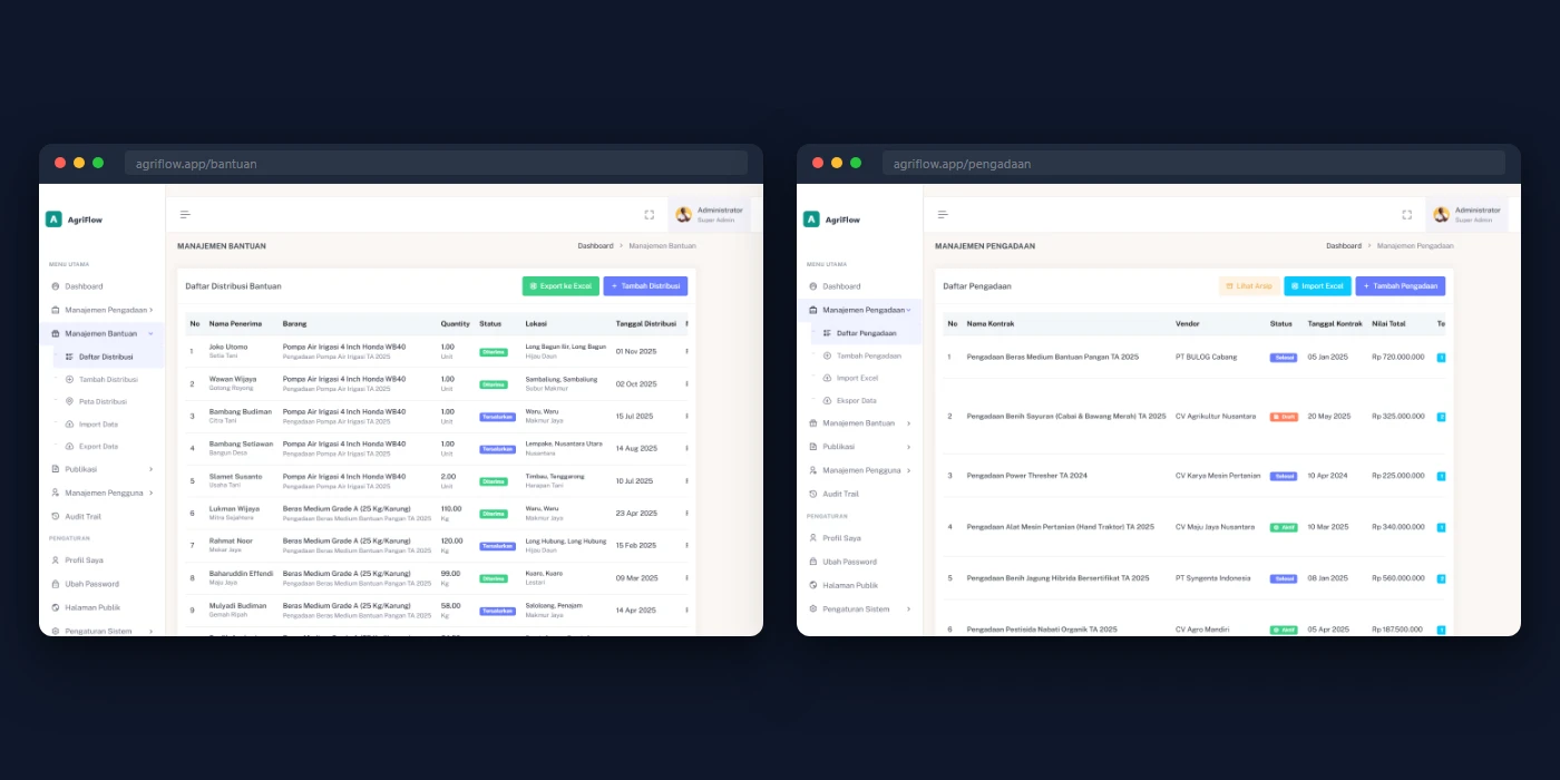
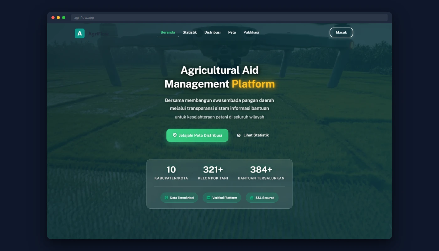
Government web app managing agricultural aid distribution across multiple regions. Officers track procurement contracts, inventory, and GPS-verified handovers to farmer groups from a single platform with a public transparency portal.
Challenge
- Procurement and distribution tracked via disconnected spreadsheets and paper forms
- Report compilation required hours of manual cross-referencing across files
- No geographic visibility into where aid was distributed across districts
- Zero audit trail for government-funded program accountability
Solution
Procurement & Distribution
- Real-time stock tracking with database-level locking against over-distribution
- 3-step distribution wizard with GPS capture and reverse geocoding
- Bulk Excel import/export with downloadable templates
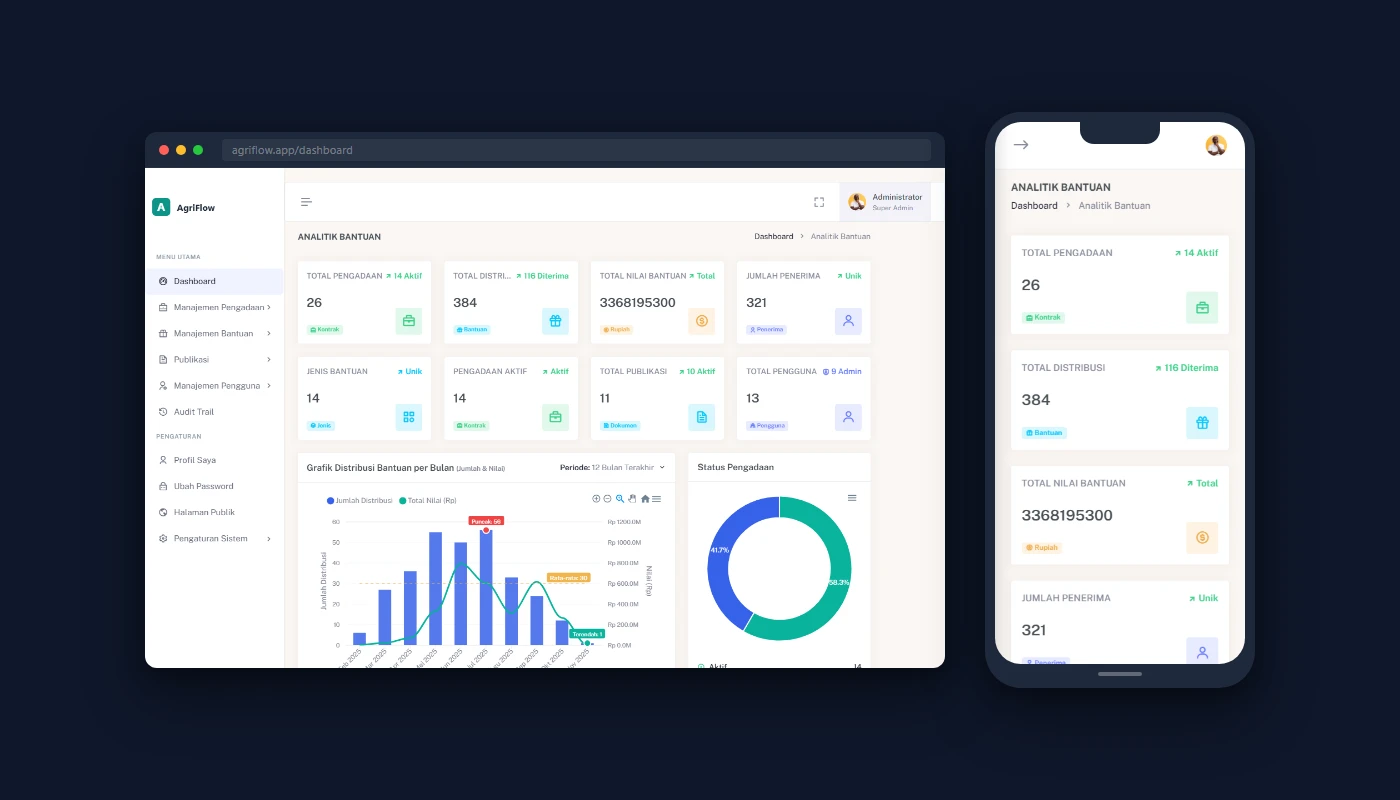
Map & Analytics
- Interactive Leaflet.js map with cascading filters and marker clustering
- Dashboard with KPIs, trend charts, and district-level drill-down
- Privacy-preserving public view with deterministic location masking
Security & Transparency
- Role-based access control: 3 roles, 34 granular permissions
- Automatic audit trail on every action with before/after diffs
- Public portal with anonymized statistics and publication downloads
Results
- Report generation: ~3 hours → under 5 minutes
- Data integrity: Over-distribution eliminated via database-level stock locking
- Geographic visibility: Zero → real-time interactive map across multiple districts
- Data entry speed: ~70% faster per distribution record